Cobe: 3D Globe With Dotted World Map Using WebGL
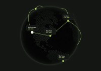
A lightweight, zero-dependency JavaScript library for creating animated 3D WebGL globes with markers, arcs, and anchored DOM labels.


A lightweight, zero-dependency JavaScript library for creating animated 3D WebGL globes with markers, arcs, and anchored DOM labels.

Generate interactive SVG maps with 212 geographic configurations, eight size presets, region click data, and optional country map loading.

The svgMap.js lets you create an interactive, SVG powered world map on the webpage, with support for Info Window which can be used to present any data when the user hovers over a specific country and region.

Create SVG vector maps with jsvectormap. Add regions, markers, tooltips, zoom controls, lines, and data-driven colors.

A JavaScript library to render an SVG based world map with all countries, provinces, and states on the website.