


The svgMap.js lets you create an interactive, SVG-powered world map on the webpage, with support for Info Window, which can be used to present any data when the user hovers over a specific country and region.
How to use it:
1. Load the required svgMap.css and svgMap.js files in the document.
<link href="/dist/svgMap.css" rel="stylesheet">
<script src="/dist/svgMap.js"></script>
2. Create a container element to place the world map.
<div id="svgMapExample"></div>
3. Create a new svgMap object to render a world map inside the container.
new svgMap({
    targetElementID: 'svgMapExample',
});
4. Determine whether to allow users to zoom and pan around the map:
new svgMap({
    allowInteraction: true,
});
5. To present data in the world map, following these steps:
// GDP data
var svgMapDataGPD = {
    data: {
      gdp: {
        name: 'GDP per capita',
        format: '{0} USD',
        thousandSeparator: ',',
        thresholdMax: 50000,
        thresholdMin: 1000
      },
      change: {
        name: 'Change to year before',
        format: '{0} %'
      },
      gdpAdjusted: {
        name: 'Purchasing Power Parity',
        format: '{0} USD',
        thousandSeparator: ',',
        thresholdMax: 50000,
        thresholdMin: 1000
      },
      changeAdjusted: {
        name: 'Change to year before',
        format: '{0} %'
      }
    },
    applyData: 'gdpAdjusted',
    values: {
      AF: {gdp: 587, change: 4.73, gdpAdjusted: 1958, changeAdjusted: 0.02},
      link: 'https://cssscript.com',
      linkTarget: '_blank'
    }
}
new svgMap({
targetElementID: 'svgMapExample',
data: svgMapDataGPD
});6. All default options to customize the world map.
// The element to render the map in
targetElementID: '',
// Allow user to zoom and pan
allowInteraction: true,
// Minimum and maximum zoom
minZoom: 1,
maxZoom: 25,
// Initial zoom
initialZoom: 1.06,
// Initial pan
initialPan: {
  x: 0,
  y: 0
},
// Zoom sensitivity
zoomScaleSensitivity: 0.2,
// Zoom with double-click
dblClickZoomEnabled: true,
// Zoom with mousewheel
mouseWheelZoomEnabled: true,
// Allow zooming only when one of the following keys is pressed: 'shift', 'control', 'alt' (Windows), 'command' (MacOS), 'option' (MacOS)
mouseWheelZoomWithKey: false,
// The message to show for non MacOS systems
mouseWheelKeyMessage: 'Press the [ALT] key to zoom',
// The message to show for MacOS
mouseWheelKeyMessageMac: 'Press the [COMMAND] key to zoom',
// Position of the zoom buttons
zoomButtonsPosition: 'bottomLeft',
// Data colors
colorMax: '#CC0033',
colorMin: '#FFE5D9',
colorNoData: '#E2E2E2',
// Ratio type for the color scale, can be 'linear' or 'log' for logarithmic or a custom function (value, min, max) => ratio
ratioType: 'linear',
// The flag type can be 'image' or 'emoji'
flagType: 'image',
// The URL to the flags when using flag type 'image', {0} will get replaced with the lowercase country id
flagURL:
  'https://cdn.jsdelivr.net/gh/hjnilsson/country-flags@latest/svg/{0}.svg',
// Decide whether to show the flag option or not
hideFlag: false,
// Whether attributes with no data should be displayed
hideMissingData: false,
// The default text to be shown when no data is present
noDataText: 'No data available',
// Set to true to open the link on mobile devices, set to false (default) to show the tooltip
touchLink: false,
// When false, disables hover/touch-following tooltips (not the on-map persistent labels; see persistentTooltips)
showTooltips: true,
// 'hover' (default): mouse shows tooltip on enter. 'click': mouse opens tooltip on click; touch/pen unchanged.
tooltipTrigger: 'hover',
// Persistent on-map tooltips: an array of country IDs, or a function (countryID, countryValues) => boolean
persistentTooltips: false,
// Set to true to show the to show a zoom reset button
showZoomReset: false,
// Called when a tooltip is created to custimize the tooltip content
onGetTooltip: function (tooltipDiv, countryID, countryValues) {
  return null;
},
// Called on country click (pointer released without dragging). Receives
// (countryID, event). Return false to skip opening data.values[*].link.
onCountryClick: null,
// Country specific options
countries: {
  // Western Sahara: Set to false to combine Morocco (MA) and Western Sahara (EH)
  EH: true
},
// Set to true to show a drop down menu with the continents
showContinentSelector: false,
// Reset zoom on resize
resetZoomOnResize: false
Changelog:
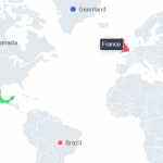
v2.21.0 (06/07/2026)
- Add static pins feature
v2.20.1 (06/03/2026)
- Improve performance
- Fix two step clicks on mobile
v2.20.0 (05/04/2026)
- add onCountryClick callback
- new opiotns: showTooltips, tooltipTrigger, persistentTooltips, onCountryClick
v2.19.3 (04/01/2026)
- Fix initial color flash on map load
v2.19.3 (04/01/2026)
- Fix initial color flash on map load
v2.19.2/1 (02/07/2026)
- Removed require() node specific function call
- Fixed css imports
v2.18.4 (01/20/2026)
- fix: call svgPanZoom constructor
v2.18.3 (01/18/2026)
- fix: require svg-pan-zoom
v2.18.2 (01/09/2026)
- Updated package
v2.18.1 (12/28/2025)
- Bugfixes
v2.17.1 (12/28/2025)
- Fix: tooltip timeout was a bad UX
- Bugfix: country filling fixed; no black flash, no missing colors
v2.17.0 (12/24/2025)
- Introduces functionality so tooltip is shown on click, too, to make it work on touch devices
- Fixes country border highlighting on hover
v2.16.0 (12/24/2025)
- Feat/optional reset zoom on resize
v2.15.0 (12/22/2025)
- feat: allow positioning zoom controls
v2.14.0 (08/23/2025)
- Add option ratioType to support logarithmic ratios
v2.13.0 (08/16/2025)
- New option allowInteraction
- Allow overriding mapControlsColor
v2.12.2 (01/07/2025)
- New option allowInteraction
- Allow overriding mapControlsColor
v2.12.0 (11/06/2024)
- Added option to use rgb and other color values
- Minor bug fixes
v2.11.1 (08/01/2024)
- Fixed bugs
v2.10.0 (06/27/2022)
- Added option to hide missing data
v2.9.0 (05/31/2022)
- Updated Equatorial Guinea (GQ) added Bioko Island
v2.8.0 (05/24/2022)
- Added option to reset zoom
- Added option to zoom to a specific continent
v2.7.2 (03/08/2022)
- Prevent firing click when dragging.
v2.7.1 (08/29/2021)
- Added flags to EURO demo
v2.7.0 (08/23/2021)
- Added option to allow mouse wheel zooming only with specific keys pressed
- Added option to add Crimea to Russia to solve issue
- Added country Kosovo
- Minor bugfixes and adjustments
v2.6.0 (08/19/2021)
- Manually set country color
v2.5.2 (07/30/2021)
- Added option initialPan
- Fixes a bug that shows the wrong color when value is below the minimal threshold
- Adds new option for custom tooltips
v2.3.0 (07/28/2021)
- Added option to open links on mobile devices
v2.2.2 (07/18/2021)
- Fixes map data maker
v2.2.1 (07/17/2021)
- Fixes wrong color calculation bug when there is no ratio
v2.2.0 (06/22/2021)
- Added option to set the target of links
v2.1.1 (02/27/2021)
- Fixes color bug
v2.1.0 (02/26/2021)
- You can now add links to each country.
v2.0.4 (02/17/2021)
- Refactored to make svgMap working with bundlers
- Fixed umd wrapper
- Added build files
- Fixed es6 compatibility
- Minor fix
v1.6.0 (12/30/2020)
- Added accessibility
v1.5.0 (05/14/2020)
- Added tooltip support for mobile devices
v1.4.2 (03/27/2020)
- Fixed slightly off position of Monaco
- Minor text changes
v1.4.0 (03/27/2020)
- Increased default max zoom to 25, so that smaller countries are selectable
- Added missing countries
- Added option to combine Morocco (MA) with Western Sahara (EH)
- Fixed country Andorra (AD)
- Fixed the path creator asset
v1.3.4 (03/12/2020)
- Add MA and EH combined
v1.3.3 (02/12/2020)
- Fixed: Singapore no longer accessible after hovering over Malaysia
v1.3.2 (01/12/2020)
- Improved z-indexes
v1.3.1 (01/10/2020)
- Fixed minor margin offset when hideFlag is option is set
- Fixed Gulp watch task
- Minor version bump
v1.3.0 (01/08/2020)
- Added option hideFlag
- Added option noDataText
- Fixed vulnerabilities
v1.2.1 (11/01/2019)
- Added main to package file
- Version bump
v1.2.0 (05/16/2019)
- Change default flag type to image
- Minor fixes and improvements
v1.1.0 (05/15/2019)
- Bugfix
See Also:
 jsvectormap: JavaScript Library For Interactive Vector Maps
 Cobe: 3D Globe With Dotted World Map Using WebGL
 SVG World Map With All Countries, Provinces, And States
 Scroll-triggered Parallax Slider In JavaScript
 Pure HTML5 / CSS Tooltip Solution
 Touch-enabled Draggable & Sortable JavaScript Library – AreaSortable.js
 Animated Snowfall Effect In Pure JavaScript
 Simplest JavaScript Countdown Timer – pureJSTimer
Instead of hovering over, I would like to apply a mouse click and open a url for the clicked location. How can I do that?
How can i add the marker to my selected countries..?
I like the script. But Is there away to make it responsive on mobile phone?